
Navigation by map and compass is a contingency skill vital to egress maneuvers, foraging in deep woods, hunting on unfamiliar lands, site finding, and other needs that may arise following a Life Altering Event (LAE). Technology, GPS, and modern wayfinding are susceptible to failure. The knowledge of basic LAND-NAV should be learned and practiced.
NAVIGATION BASICS
The purpose of LAND-NAV is to have the capability to follow a route through unfamiliar terrain on foot or by vehicle, using maps and pathfinding tools paired with the knowledge of terrain comprehension. It does not require anything more than a map and compass (and maybe a pencil). Additional tools can aid but are not required. We’ll cover the basics now.
Know your map types. USGS topographical maps in a 1:50,000 scale are recommended. These maps are typically available on OSINT sources online and can be printed by area through sites such as,
https://www.usgs.gov/core-science-systems/national-geospatial-program/topographic-maps
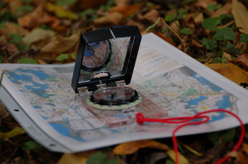
Understand the components of a map. A Grid Note is the location of the grid square, typically expressed according to some variation of the Universal Transverse Mercator (UTM) coordinate system. A Declination Diagram shows the relationship between grid north and magnetic north. The Scale is a representative fraction giving the ratio of a map to corresponding distance on the Earth’s surface. Bar Scales are rulers used to convert map to ground distance.
Learn how to read grid coordinates. On a typical UTM topographical (topo) map, each grid represents a 1,000m square. The grid note on the map denotes the region, which is a 100,000m square. In USNG coordinates are expressed by two letters. Keep in mind when plotting grid coordinates, always read right and up.
To find the grid location of an object on the map, first find the closest easting line to the west of your target location. Then, find the closest northing line to the south of your target location. This will give you your 4 digit finding. Each further step increases proximity by narrowing down using 2 more digits at a time. Go right and up from the southwest corner of the four digit grid location in 100m increments. Go right and up from the six digit location in 10m increments.
4 digit is accurate to 1,000m
6 digit is accurate to 100m
8 digit is accurate to 10m
You’ll need to be able to visually identify key terrain features and associate your environment’s observations to your map reading observations. The features are categorized as Major, Minor, and Supplementary.
MAJOR
1. Hill: An area of high ground from which the ground slopes away on all sides.
2. Saddle: An area between two hills, where the ground slopes up on two sides, and down on two sides.
3. Valley: Low ground between two ridgelines or high areas.
4. Ridge: Elongated, sloping high-ground area. Contour lines of a ridge will form v’s and u’s that point toward the lower ground.
5. Depression: Sinkhole or other low point in terrain characterized by steep or sheer walls.
MINOR
6. Draw: A small area of low ground between spurs.
7. Spur: A smaller version of a ridge, usually extending off of a ridge.
SUPPLEMENTARY
8. Cliff: A vertical or near vertical drop-off. Contour lines indicating a cliff will converge, or nearly converge.
9. Cuts and Fills: A man-made cut through high-ground, or fill-in low-ground, respectively. Mountain roads and railroads will often correlate with these features. On the map, the stubby lines of a cut or fill point toward the lower ground.
Summary: This is a rudimentary introduction to LAND-NAV. Prior military or avid-outdoorsmen should find it as a useful refresher but if you have no experience, you’ll want to follow up soon with additional training. Ideally obtain access to a land navigation course on a military base with a SM that could allow you to train with them during off-duty hours.
There are many military manuals, study guides, and civilian orienteering clubs that offer classes and practical exercises. Find one, get training.
Land Navigation is one aspect of a prepper’s responsibility for self-sufficiency. Knowledge of emerging events, law changes, and threats is essential. Sign up for Intel and Situational Awareness updates via the Grayman Briefing.