
Situation
I was working in East Africa in early 2015 and woke one weekend morning craving some decent food and a cool swimming pool to wind down from a long week traveling the sub-Saharan bush. There was a strange buzz within the city reeling from ethnic tension, culminating with large crowds descending on the downtown square for a women’s march protesting a ban on, among other things, gatherings to protest.
There was also a large presence of heavily armed national police and organized groups of fighting-aged males in olive drab, unmarked uniforms, marching with fixed bayonets on AK-47s positioning themselves to intervene and control the protesters with extreme force. The embassy had warned us of the coming conflict, but braving a drive through the chaos was well worth it for an afternoon of relaxation.
Walking out of the team house and hopping into an SUV that was leased by the team, I met a new driver: Dessie. Dessie was a large guy and happened to be of the same ethnicity as the country’s majority tribe, which was responsible for this crackdown and for a massive genocide that occurred in the mid ‘90s combined with a civil war that raged well into the 2000’s, leaving a heavy toll of death and horror on the population of the small country. He spoke broken English, so I shook his hand and gave him my destination in English and French, with a splash of the local dialect.
As we pulled away from the team house, the driver’s supervisor shouted something to Dessie and gave the universal symbol for “keeping one’s mouth shut,” an index finger pointing up over the mouth. The immediate tingle that ran up my spine was overruled by my desire for a good pizza and cold beer, so off we went, just the two of us.
During the 30-minute trip, I immediately started to look for ways to get back to the team house if I ended up isolated. Not that I thought that Dessie would have sold me for cigarette money, but I indeed felt that he could have easily not been able to return across the city to fetch me in the event of a full-blown genocidal crackdown happening.
So, first step was a personal inventory. Smart phone, auto-opening combat knife, passport, multi-tool, and a bottle of water stuffed into a back pack. Unlocking my smart phone, I went to a common map app and was shocked that the data for the phone was not working. I had heard the government could cut data services, and I wondered if this was in fact happening.
As the pucker factor was rapidly increasing, I remembered purchasing a GPS app that could operate independently of a smart phone’s data plan. Thankfully, I was able to open it and drop a waypoint before we left the neighborhood. Even with a smartphone, I still started to look for landmarks that would guide me back in the event my phone’s battery died, it was lost, or stolen.
Long story short, I made it to the resort, enjoyed relaxing by the pool, and, true to his word, Dessie picked me up and returned me unscathed to the team house. Now, there was some drama on the road both ways, but we’ll save that for another time.
We need to discuss what would have happened if I did not have the GPS app and I was dead reckoning my way back.
Dead Reckoning
“Dead reckoning” is a term used in navigation that refers to the process of calculating one’s current position by using previously determined positions, or targets. Sometimes—say if you’re visiting a city with an ocean, large lake, or mountains—dead reckoning is easy from a standpoint of visibility, but what about more flat locations?
One alternative is to use a city’s street numbering and naming system, or the study of “odonyms.” I’ll warn you, this is a much more difficult way to navigate and you need to back up your movements with a map if at all possible. Streets were named and buildings numbered many, many years ago. Urban sprawl, population density, and the need of traffic patterns to accommodate them have altered the cityscape so that the rules may not always apply.
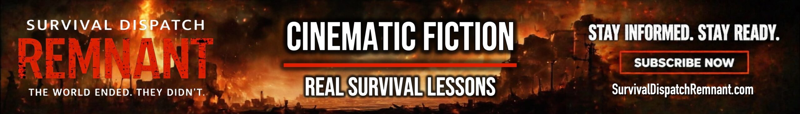
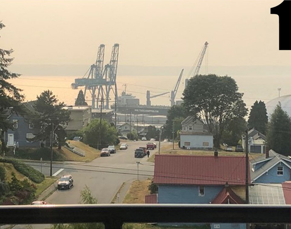
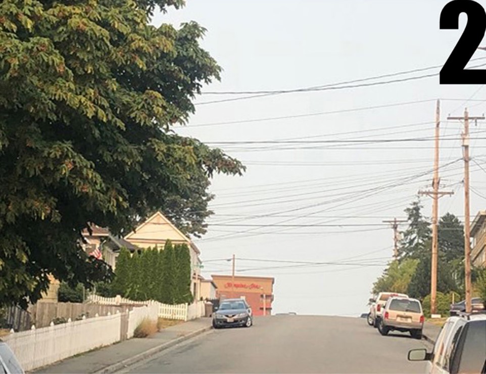
While taking the following pictures from my hotel balcony of a “target reference point,” and subsequently taking pictures from the target reference point and from another elevated position on the city limits, I found that many of these road name rules just did not apply.
Starting at the first picture (1), you can see the dock cranes that I am using as a target reference from my hotel balcony. Next (2), a shot of the hotel and 6th floor balcony from the neighborhood in front of the docks and finally (3), a shot from the edge of town where I found my target reference point—the cranes—and would know the direction to my hotel from any elevated position.
Odonyms
Diving right into the study of road names, or “odonyms,” one can quickly spend a night reading and getting more confused paragraph by paragraph. When is a street a street and not a lane? When is a boulevard not an avenue? Highways versus interstates or freeways? The last thing you want is to be facing a SHTF situation, evading or attempting to navigate a large urban landscape and have to remember all these rules. Especially when you go to someplace like Detroit and have a road rule that is based on the mile system starting at Michigan Ave., or worse, Salt Lake City where the roads are numbered based on their distance from the headquarters for the Church of Jesus Christ of Latter-day Saints.
So, get your highlighter and note cards out and make some flash cards. Again, keep in mind that buildings and roadways are demolished every day and are being rebuilt to accommodate heavier traffic patterns as well as for commercial, residential, and consumer needs. So, the rules may or may not apply and can easily be left up to the whims of the developer or a city planner and how they have changed the landscape as it pertains to road types.
Road Definitions:

WAY – Small side street off a road
ALLEY – Small pathway between buildings
AVENUE – Stretch of road that has trees and buildings on both sides (normally run North to South)
BOULEVARD – Similar to an avenue but wider, with a median down the middle
LANE – Narrow rural road
DRIVES – Lone and winding, following the natural features of the surrounding area
TERRACES – Follows the top of a ridge line or slope
PLACE – Road with dead ends, normally residential
COURTS – Loops without a thruway, also called a cul-de-sac
And let’s not forget the highways, freeways, and turnpikes:
HIGHWAY – Two to four lanes that have access roads, drive ways and parking lots or business entrances that feed directly off the road. May or may not have a median or barrier between facing lanes
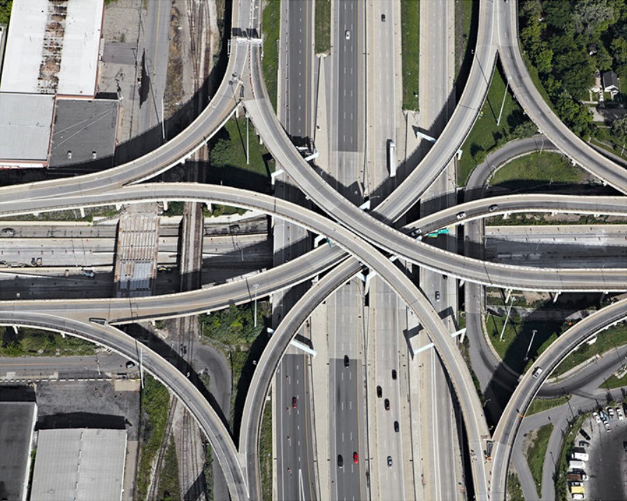
FREEWAY – Multi-lane roads that have no intersections, are free to travel and have no stop lights. There will be an on and off ramp to enter and exit as well as a barrier to separate both lanes of oncoming traffic
TOLL ROAD – Exactly like a freeway, except you have to pay to drive. Many have service plazas that feed directly off the road so that you don’t have to pay to exit and re-enter. Also called a turnpike.
PRO-TIP: Even numbered highways in the U.S. generally run East/West and odd numbered highways generally run North/South.
Business and Residential Numbering:
Around the world, home or business numbering is done in many different ways, so it is absolutely imperative that you do research before traveling away from home. One trick I use is going to a major search engine that has maps, directions and even a road-view and I track my trip from the airport to hotel, and hotel to work location. I spent a week before traveling to Italy, “driving” the roads and learning my surroundings BEFORE I even boarded the plane. Renting a car and traveling to and from the hotel was a breeze after this little bit of research. Because of this, I also was able to find the best restaurants and historical sites.
As far as finding your direction in any town in the U.S., it’s a pretty fair bet that there is a Main Street. If you find yourself on a Main St., keep in mind that in most U.S. cities, the lower the number of the cross street (e.g. 2nd St.), the closer you will be to city center and higher the number of the street, the further away.
As for building and house numbers, odd numbers will normally be on one side and even on the other with the lower numbers towards the center of town and higher numbers as you travel further away. I can’t stress enough that I have found issues with these numbering and naming systems pretty much everywhere I travel.
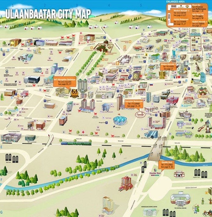
Another great pro-tip is to utilize tourist maps whenever possible. Tourist maps come in many shapes and sizes and are designed to be read by the not-so-navigation-savvy. They have large cartoon-ish graphics, lost of landmarks and can be read on the run. I never pass one up.
Final Thoughts
We’ve covered quite a bit of material, but with some practice and planning, you can easily learn to navigate yourself through a major city WITHOUT A GPS, smart phone, map or having to ask for directions. Remember, if you look lost and are wandering around asking for directions, someone with criminal intentions will see it too.
This article was originally published in Survival Dispatch Insider Volume 2 Issue 9.