


SDN has moved!
Subscribe to our new @SurvivalDispatchNews YouTube channel

When you find yourself in a survival situation, there are many decisions to make. You might find yourself lost in the woods. Perhaps your car broke down in the country and the nearest home is miles away. Maybe you went hiking or camping off trail and got turned around.
I have even heard of scenarios in which a person has left their vehicle to pick mushrooms and got lost only a mile from their car. What matters is not how you become lost. What matters are the decisions that you make to enact your rescue.
Stay or Go?
The general rule for survival is to stay put and wait for rescue. However, there are times that this strategy will not get you home. You may have headed out without telling anybody where you are going. If nobody knows that you are missing, it is unlikely that a search party will be sent.

via nationalgeographic.com
You may have travelled to a wilderness so vast that rescue personnel would never find you. (Be sure to read this article on Survival Signaling) You may have been injured or are in need of life saving medication.
Or you are in an area so devoid of water that you could die of dehydration before help finds you. In all of these cases you cannot afford to sit around and wait for help to come.
Resources
Part of your decision whether to attempt to hike out or not must be based on your available resources.
- Do you have food or water with you?
- Do you have a way to start a fire?
- Do you have a way to make a shelter?
A best case scenario would be to have a bug out bag, get home pack, or other pack of resources with you. I try to always carry a pack like this when I know I will be in the wilderness. These are resources that could both allow you to stay put longer while waiting for help, and could allow a more successful hike out.

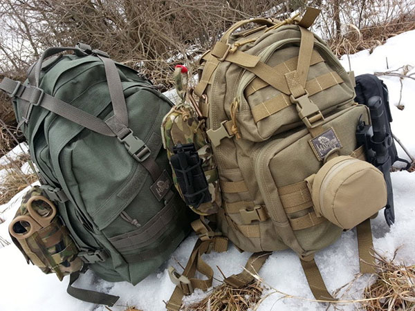
Ideally you’ll have your kit with you when an emergency arises (via the Prepper Journal)
Navigational Resources
Navigation tools and knowledge should be one of the largest factors in your decision to try and hike to find help. If you have GPS, a map, or a compass, your odds of finding civilization are significantly better than randomly tromping through the woods.
In addition, if you know other ways to navigate without these tools that knowledge can give you a huge advantage. If you are hiking blind, you are typically better off staying put and waiting for help.
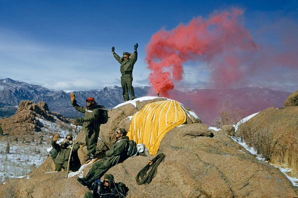
Another type of resource that is vital in this decision are signaling tools. If you have more ways to signal for help, it may make more sense to stay put.

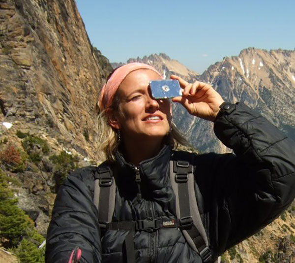
Using a signal mirror
Signaling Resources
For example, if you have a signal mirror and can get to a high spot, you can signal people on the ground and in the air. If you have anything plastic to burn, you can make a jet black smoke signal. If you have green wood, you can make a bright white smoke signal.
Whistles are great for audio signals along with anything metal you can bang on. LED flashlights along with laser pointers are good for signaling at night over long distances. Of course, flare guns are great if you happen to have one in your pack.
The ultimate resource that almost definitively says you should stay put is if you are with a vehicle. Vehicles are large, metallic, and often brightly colored. If rescue teams are looking for you, they will first look for a vehicle.
In addition, you have tires to burn, padding for insulation, and a battery to start fires. You have wiring for cordage, a horn and headlights for signaling, and gasoline for a fire accelerant. You can even bang on the hood or trunk lid to make a good metallic sound for signaling. Very rarely would I say you should leave a vehicle to go look for help.
If You Are Going to Leave…
Whether you decide to hike for help or stay put and wait, you are going to have to live with that choice. However, if you do decide to hike out you need to take some precautions to ensure that rescue parties can still find you.

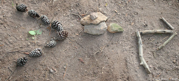
via National Wildlife Federation
At the point where you head out, you should always leave a large arrow on the ground indicating your direction of travel. This arrow should be large and bold enough that an aircraft can see it from a distance. Every time you take a break, you should leave another large arrow so that your path is more likely to be seen.
In addition, you should always blaze a trail when you are hiking away from roads or trails. Blazing a trail can be made with colorful tape, paint, or with a blade. To blaze a trail with a blade, you simply need to chop through the bark of a tree exposing the white wood underneath. If you do this every few steps, it will leave a clear trail for rescue personnel to follow.
In addition, if there is any reason you may need to retrace your steps you can blaze a trail on the back side of each tree. This is valuable if you are out searching for better resources like water and food.
GPS and Other Technology
These days both the best and worst ways to navigate in the wilderness are with satellite and cellular based devices. I say this because you can get the most accurate information the fastest with these devices, but only if they work.
You can directly reach rescue crews or family members the fastest with these devices, but only if they work.
There is a lot that can go wrong in the wilderness. If you are in a car accident, fall down a hill, or drop them on a rock, most of these devices are rendered worthless.
In addition, batteries can die quickly when a devices is constantly searching for a signal. All these devices have blind spots where they get no service. For cellular devices this is normally low spots in the middle of nowhere.
For satellite devices this is normally in dense forests, caves, or buildings where you have something overhead. Neither type of devices works 100% of the time.

Cell Phone
I still suggest that you have one of these devices with you at all times. Of course my cellular phone allows me to make outbound calls for help most of the time. I use the GPS on my cellular phone all the time to find the closest road or body of water. It also has a satellite view that shows me details of the landscape.
In 80% of the wilderness environments I visit I can distinguish deciduous forests, dense groves of evergreens, logging roads, dry creek beds, rocky outcrops, and clearings all from the satellite image.
I can also see the nearest buildings to try and find people if needed. With an overlay of the area from the parks department I can find the nearest ranger station. The problems are keeping the battery charged, and then that 20% of the time that I do not have a signal.
Other Devices
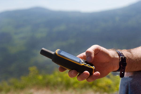
There are three other satellite devices that can help you find your way home:
- A separate GPS device can show you the satellite image, a topographical overlay, and can even allow you to flag points on the map so you can come back later or see your overall progress.
- Satellite phones will allow you to make calls to the authorities or to family members if you get in a bind.
- Personal Locator Beacons (PLBs) pinpoint your exact location and send a rescue team to that spot, but you must register the device with local authorities in advance.
The GPS device burns up the battery quickly, but the Sat-phone and the PLB stay charged for quite a long time.
One of the biggest downsides to these devices is the cost. To buy one new could cost you several hundred dollars along with a monthly fee in some cases. I suggest you find a used option in good shape and only use these devices when you know you will be leaving major roads.
This will keep your cost to a minimum while still giving you added protection. Remember that a normal cellular phone will work in most parks with established trails, but you can always call the ranger station to ask about cell service in the area.
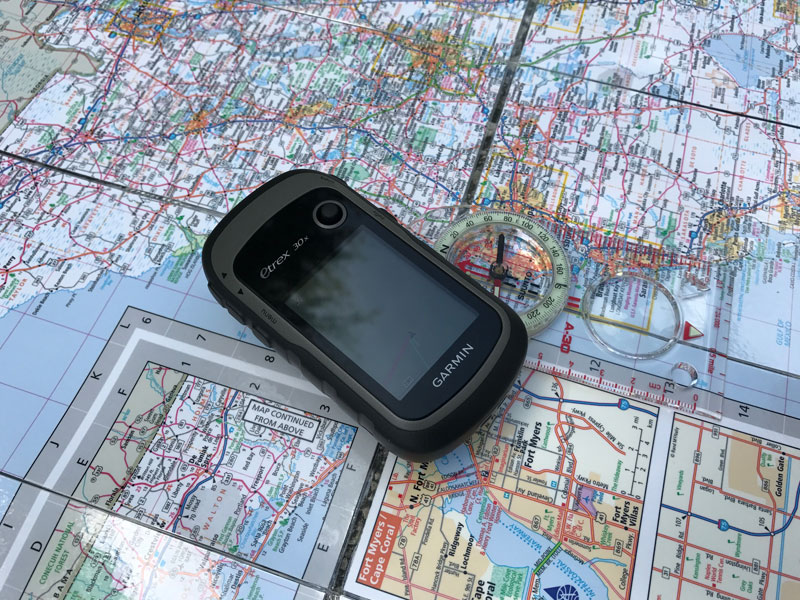
Map and Compass
Sometimes the best solution is the most simple. With an accurate map and a compass, you rarely have to worry about batteries, breakage, or signal strength. However, you do need to know how to use them together and by themselves.
I used to work at a job that required me to route out several points and efficiently visit all of those locations. I used a map and compass while everybody else relied on GPS. I moved every bit as quickly as they did, and I did not have to worry about the signal or battery failing.
I was always on the move. However, reading a map and compass are becoming lost skills. Even my father does not know how to use a compass these days.
Using Together
By far the most productive way to use these tools is together. A good map should have landmarks that are easy to recognize from a high point. A topographical map is always best because it shows peaks and valleys. However, any map that shows roads, trails, and bodies of water can be used.
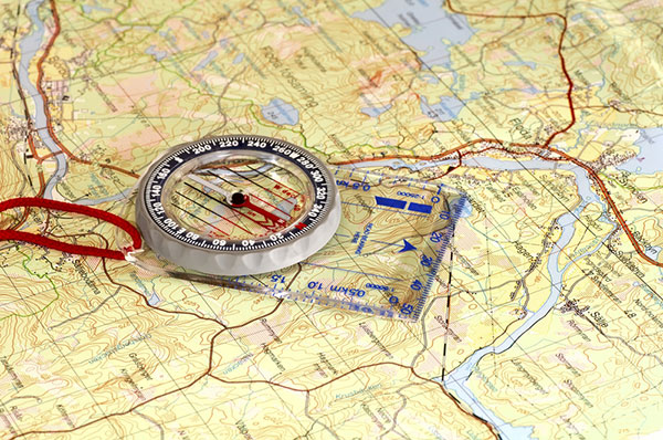
First set the map on a flat surface and the put the compass on top. Orient the compass so that the needle is pointing straight at magnetic North. Then rotate the map until North on the legend lines up with North on the compass. Now you should have all of your landmarks lined up so you know in which direction to travel. Heading towards water, roads, or trails are always a good call. Of course, any buildings marked should be a target as well.
Using Separately
You can also use these tools separate from each other if needed. For the map, you will need to get to a high point where you can see roads, trails, or bodies of water. You can then use the map to line up these landmarks and also determine which way is north from the legend.
Lakes and rivers are especially helpful for this as they have distinctive curves to help identify them.
In order to use a compass without a map, you have to already know a general layout of the area. If you are headed west away from a vehicle, you probably want to keep heading west. If you know there is a river to the North, you can just keep hiking north until you find it. You just have to be sure that the compass is level with the ground before taking your reading.
Final Thoughts
It is always a difficult decision to leave your current location and start hiking through uncharted territory. However, with some of these tools and tactics you can be confident if you do decide to head out.
The worst feeling imaginable is walking through the woods and having absolutely no idea where you are going. If you stay prepared by having these tools with you and you know how to use them, this feeling will never happen.
However, you cannot just wait until the situation arises. You need to get out into the woods and practice using these tools in advance. With a little practice you can become an expert navigator.
=====
Become a Survival Dispatch Insider …
We bring together survival enthusiasts and preppers to share skills and knowledge, so you can enhance your preparedness for emergencies and ensure the safety of you and your community.
The Results You’ll Get …
Our community, courses, and memberships are pretty special. We focus on the ways it will make a huge difference in your life.
Here are a few of the things you’ll be able to do as a member of Survival Dispatch Insider …
1) Improve your emergency preparedness by learning survival skills and strategies from experienced preppers.
2) Build lasting connections with like-minded individuals that share your passion for safety and readiness.
3) Access a wealth of knowledge and resources to assist in protecting you and your community during unexpected situations.
Click HERE to get started.
=====